
Imbalance Satellite Image Colorization with Semantic Salience Priors
Semantically guided colorization for imbalanced satellite imagery
Twelfth International Conference on Graphics and Image Processing, 2021
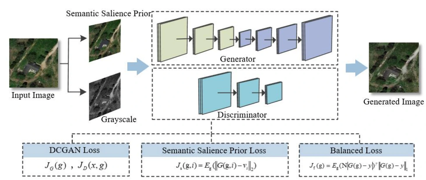
Method overview supplied by the project author.
I. Overview
Satellite-image colorization is under-constrained: many colors may be plausible for a grayscale input, while dominant land-cover types can bias a model toward frequent outputs. This work introduces semantic salience priors to emphasize meaningful scene regions during color prediction.
II. Key Contributions
- Incorporates semantic salience into satellite-image colorization.
- Addresses imbalance among common and infrequent scene content.
- Guides color prediction with higher-level scene information in addition to local intensity.
III. Methodology
The supplied overview shows a learned colorization pipeline augmented by semantic and saliency cues. These priors reweight or refine visual features so the decoder can assign colors according to scene content rather than frequency alone.
IV. Research Focus
The project explores how semantic structure can stabilize colorization when training data contain uneven land-cover and color distributions.
Reference
Citation
BibTeX citation
@inproceedings{zheng2021imbalance,
  title={Imbalance satellite image colorization with semantic salience priors},
  author={Zheng, Chengyu and Fu, Yu and Zhao, Zian and Wang, Chenglong and Nie, Jie},
  booktitle={Twelfth International Conference on Graphics and Image Processing (ICGIP 2020)},
  volume={11720},
  pages={546--552},
  year={2021},
  organization={SPIE}
}
Continue exploring
Related Projects
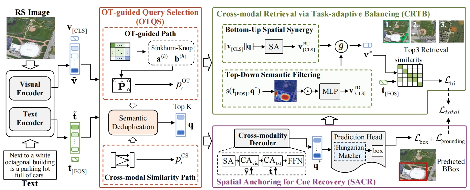
Explicit Spatial Localization and Task-Adaptive Balancing for Remote Sensing Image-Text Retrieval
A remote-sensing image–text retrieval framework that combines explicit object localization with adaptive coordination between spatial and semantic learning objectives.
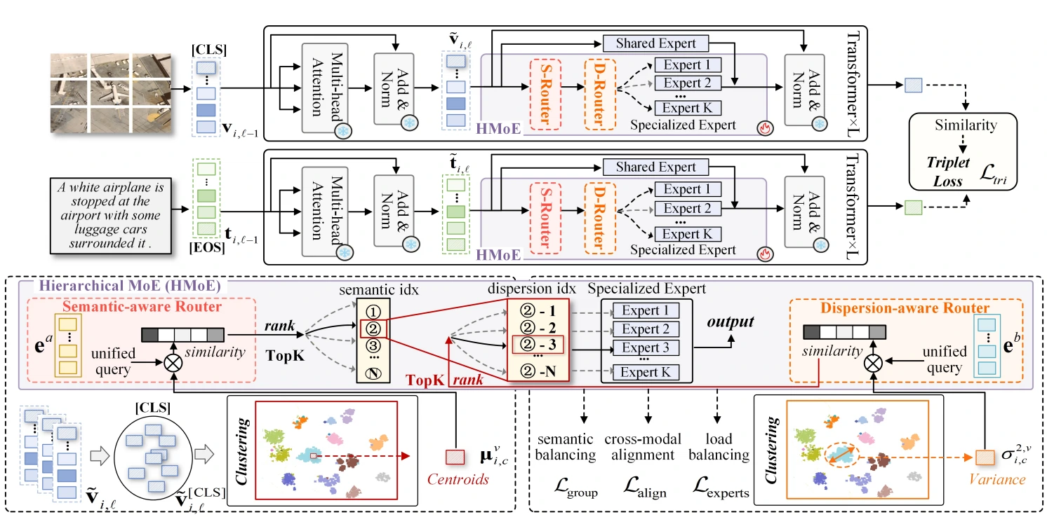
H-MoC: Hierarchical Mixture-of-Experts for Semantic- and Dispersion-Consistency in Remote Sensing Image-Text Retrieval
A hierarchical mixture-of-experts retrieval framework that promotes both semantic consistency and balanced feature dispersion across remote-sensing image and text representations.